

FRAGILE EDGES

A Mapping Exercise
Analysing the various aspects of the Solent area and creating an overlay map to identify the areas that are most at risk of: wetlands, endangered species, migratory birds, and sewerage affecting these areas. This data can then be used to create a set of rules depending on the level of risk of each location.

Levels of Risk
Further Analysis
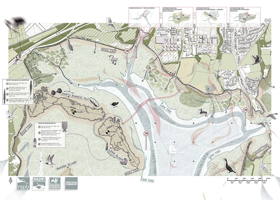
Zooming in on the area most at risk, further analysis of the history of the site can be undertaken to gain an idea of the types of resources available and the previous uses of the land. Moreover, research on current uses can indicate whether this is a suitable location to choose for the intended use.

Uses of the Site
Considering the historic uses of the chosen site, this has influenced the masterplan goals through including salt pans, leading to Thalassotherapy and Halotherapy rooms, which in turn creates wetland habitats that can sustainably process waste water from the facilities.
Linking the functions to the nearby island to continue the journey through the site also attracts those wishing to visit the area but not use the spa facilities, as this is an opportunity for a boat trip and wildlife-learning experience, especially for young people in the nearby schools.

Salt Pans

_gif.gif)
Thalassotherapy
Gallery


Building Regulations
In order to create challenges for ourselves as well as ensure that our structures are environmentally-friendly, we devised a set of Building Regulations based on the UK-standard regulations for each of our chosen sites within the Levels 4 and 5 locations of the Solent.


